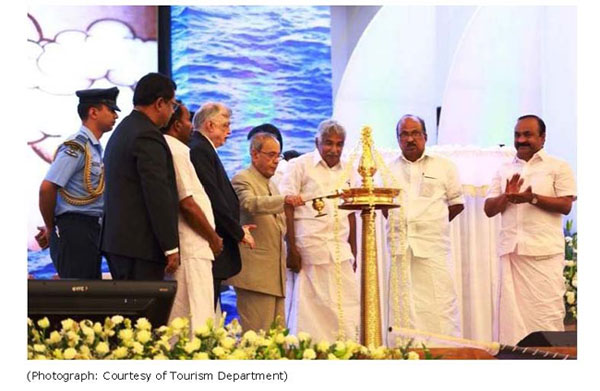
Two of the major projects involving the GIS team of IKM have been successfully launched recently. First one is inaugurated by Honourable President of India Shri. Pranab Mukherjee and the second one by Shri.Manjalamkuzhi Ali, Minister for Urban Affairs and Welfare of Minorities.
1. Muziris Heritage Project
This is one of the prestigious and costly projects of Department of Tourism, meant for protecting the sanctity and historic values by conservation and safeguard the cultural assets of this Muziris region, and make this a must see destination in the World Tourism sector comprising an area of around 127sq.km between the two municipalities namely North Parur of Ernakulam and Kodungallur of Thrissur districts. The project region also comprises of Chennamangalam, Chittatukara, Vadakekkara, Pallippuram grama panchayats of Ernakulam and Eriyad, Mathilakam and Sreenarayanapuram grama panchayats of Thrissur districts, in between the two municipalities. IKM has been entrusted to complete the Resource Mapping of the Muziris area based on the cadastral maps prepared by the Department of Survey & Land Records and we have successfully completed our part and the digital data handed over to the Tourism Department on 15/06/2012 Honourable President of India Shri. Pranab Mukherjee inaugurated the first phase of this prestigious project at International Research and Convention Centre, KKTM College, Kodungalloor on 26/02/2016. The outcome can be reached by the public at http://gis.lsgkerala.in/maps/muziris/
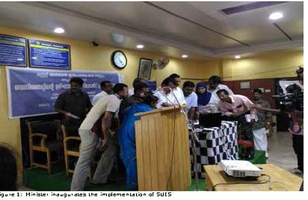
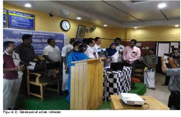
2. State Urban Information System (Malappuram Municipality(Premises Mapping)
This project is initiated by Department of Town & Country Planning forcapturing the footprints of all building structures including socio economic data within Malappuram municipality, joined hands with well experienced GIS team of Information Kerala Mission and NCESS for implementation. The major objective of this programme was to design, organize and establish a comprehensive information system in the urban local body for planning, management and decentralized governance. Components involved were original high resolution satellite data interpretation, overlying with cadastral maps, data extraction, DGPS survey, physical survey, socio economic survey, data entry of spatial and nonspatial data, attribute linking, atlas and project report preparation. The project was inaugurated by Shri.Manjalamkuzhi Ali, Minister for Urban Affairs and Welfare of Minorities on 03/03/2016 at Malappuram municipality. The Geospatial atlas was also released in the programme. The project can be accessed at http://gis.lsgkerala.gov.in:8080/UIS/index.php.